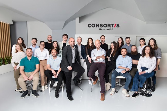
About us
Consortis Geospatial
Through every project, we develop cutting-edge technology and leverage the accumulated experience from a long series of complex projects that have earned the praise of our clients.
Through every project, we develop cutting-edge technology and leverage the accumulated experience from a long series of complex projects that have earned the praise of our clients.
Growth. Expertise. Optimization.
Our geospatial experts deliver effective, user-friendly solutions by leveraging open-source software to minimize costs without sacrificing quality. Combining GIS and Geoinformatics with computer science and engineering, we offer specialized services in data analysis, mapping, and spatial planning.

George Tsakoumis is an accomplished surveying engineer with over two decades of experience in town planning, spatial planning, and infrastructure projects. As the founder and CEO of Consortis Geospatial, he has led comprehensive technical advisory and management consulting services for public and private sector clients. His companies specialize in project management, urban planning, real estate development, and the application of geoinformatics technologies. He has been instrumental in coordinating and developing surveying, cadastral, environmental, hydraulic, architectural design and traffic management studies.
Mr. Tsakoumis holds a Degree in Rural and Surveying Engineering from Aristotle University of Thessaloniki and an MSc in Environmental Design of Cities and Buildings from the Hellenic Open University. His educational background provides a strong foundation in geosciences and environmental design, enabling him to address complex engineering challenges. His skills include proficient use of AutoCAD, GIS software, and comprehensive knowledge of energy and environmental issues.
He has held significant positions in professional organizations, including his present position as a Vice President of the TCG’s (Technical Chamber of Greece) Assembly Presidium, President of the Technical Chamber of Greece's Department of Central Macedonia and President of the Association of Rural and Surveying Engineers of Northern Greece. His leadership in these roles has involved organizing national conferences and professional seminars, showcasing his effective communication skills, network-building abilities, and team leadership. Mr. Tsakoumis's dedication and contributions have made a significant impact on the engineering community.
CEO and founder of Consortis Geospatial

Nikolaos Antoniou is a surveying engineer and expert in technical project management. A graduate of the Department of Rural and Surveying Engineering at the Aristotle University of Thessaloniki, he also holds a postgraduate degree specializing in Project Management.
With over 20 years of professional experience, Mr. Antoniou began his career in 2002 as a freelance surveyor. In 2005, he became a partner in a newly established engineering firm that, through innovation and collaboration, evolved into today’s Consortis, a leading force in the sector.
Mr. Antoniou has honed his expertise in topography, cadastre, urban planning, legislation, and public procurement. His deep understanding of these areas, coupled with years of hands-on experience, has been instrumental in his rise to the position of Development Director at Consortis.
Since 2018, Mr. Antoniou has been managing one of Consortis’ most significant contracts: a comprehensive cadastral study and the provision of support services for the creation of the National Cadastre in the remaining areas of Thessaloniki within the Central Macedonia Region.
A strong advocate for professional growth and continuous learning, Mr. Antoniou actively participates in national and international conferences. His leadership roles in professional associations, including the Central Macedonia Public Works Consultants Association (SMEDEKEM) and the Hellenic Association of Rural and Surveying Engineers (PSATM), underscore his commitment to advancing the field. Since 2024, he has also been serving as a member of the Governing Committee of the Technical Chamber of Greece (TEE/TKM).
Known for his dynamic personality and his communication skills, Mr. Antoniou plays a pivotal role in Consortis’ development through innovative approaches and effective collaboration.
Business Development Director

Alexandros Νtoulas, Partner and Technical Director at Consortis Geospatial, is a Surveying Engineer with an M.Sc. in Geoinformatics from the Aristotle University of Thessaloniki. He has over 16 years of experience and a solid technical background in the design, management, and implementation of GIS, photogrammetry, and topography projects.
He began his professional career during his studies, participating in topography projects. After his graduation, he participated in the implementation of construction projects such as the redevelopment of the new coastal front of Thessaloniki, the M2 building of the Thessaloniki Concert Hall, and numerous residential projects. Subsequently, he worked with several companies on a variety of major surveying, cadastral, transport, and GIS projects in Greece and the Western Balkans. He leads Consortis Geospatial, managing complex projects in earth observation, web/mobile app development and GIS consulting services.
He is a member of the Technical Chamber of Greece, the Hellenic Association of Rural & Surveying Engineers, and the record of Consulting Engineers of the Greek General Secretariat of Public Works.
As a technology enthusiast, Alexandros has delivered numerous tutorials, presentations, and papers at conferences, exhibitions, and workshops in Greece and abroad. He is fluent in English and Spanish.
Technical Manager

Stathis is currently completing a Master of Applied Informatics at the University of Macedonia, specializing in Application Development and Cloud Computing. He is also a graduate of the Department of Topography and Geoinformatics Engineering at the Technological Educational Institute of Central Macedonia (now IHU).
Over the past four years, he has cultivated expertise in Database Engineering, with a focus on both relational (PostgreSQL) and NoSQL (MongoDB, Neo4j) databases, as well as IoT data integration. His role also extends to Application Development, where he engages in JavaScript development and configuration, collaborating closely with the development team to deliver efficient web-based solutions.
As a GIS specialist, his work centers on the integration of Geographic Information Systems (GIS) with database infrastructure modeling. He designs systems to host geospatial data, enabling seamless integration into applications and ensuring efficient data management and presentation for clients and the public.
Since joining Consortis Geospatial in February 2020, he has expanded his technical skill set and gained invaluable experience by collaborating with engineering teams on a variety of public and private sector projects.
He is deeply passionate about the ever-evolving field of technology, particularly in GeoInformatics and Data Engineering. This passion fuels his commitment to continuous learning and innovation, as he aims to push the boundaries of what is possible in GIS, database management, and application development.
Senior Data Engineer

Dimitris graduated in 2019 from the Department of Rural and Surveying Engineering at Aristotle University of Thessaloniki. During his studies, he attended numerous seminars and collaborated with various companies, focusing on areas such as geodesy, land use, and information management within GIS environments. He is currently pursuing a Master’s degree at Lund University in Sweden, specializing in both GIS as software and programming (Python, SQL) to enhance its functionality.
In December 2018, he joined the Cadastral Department of Consortis Geospatial, before taking a temporary leave to fulfill his military service. Throughout his professional career and military tenure, his responsibilities primarily revolved around data management, processing, and visualization, gaining substantial experience in these critical fields.
With involvement in a wide range of professional activities and a strong commitment to learning and development, he has specialized in automated data management methods, with a focus on Geospatial Data Processing and Web Mapping applications.
Senior Spatial Analyst

Andreas is a graduate of the Department of Surveying and Geoinformatics Engineering at the International Hellenic University (IHU), with over five years of professional experience in the field of Geoinformatics. He specializes in the design and development of Geographic Information Systems (GIS), with extensive expertise in tools such as ArcMAP, QGIS, AutoCAD, and PostgreSQL. Additionally, he possesses strong skills in web development, using technologies such as HTML, CSS, and JavaScript.
Since 2023, he has been a member of the Consortis Geospatial team, contributing to projects in both the public and private sectors. His work focuses on delivering solutions that enhance the management and visualization of geospatial data. His expertise enables him to design and implement advanced geospatial systems that maximize the value of data and improve operational efficiency for clients.
Driven by his commitment to continuous growth, he stays updated with the latest technological advancements in geoinformatics, ensuring he always delivers innovative and effective solutions.
Senior GIS Data Engineer

Vasiliki is a graduate of the Department of Rural and Surveying Engineering at the Faculty of Engineering of Aristotle University of Thessaloniki, specializing in Cadastre, Photogrammetry, and Cartography. During her studies, she attended numerous seminars and workshops that enhanced her knowledge of modern surveying and cartography practices.
She has worked on the classification of high-precision satellite images, delving into the field of Remote Sensing. Additionally, she gained experience in a surveying office, where she prepared topographic diagrams and conducted ground mapping, improving her skills in surveying analysis and practical applications. At the same time, she developed strong communication and collaboration skills, with this position contributing significantly to the overall development of her knowledge and abilities.
In recent years, she has been part of the Consortis Geospatial team, where she continues to expand her expertise in Geographic Information Systems (GIS) and applies it to innovative surveying projects, focusing on the field of Geoinformatics. This experience enables her to grow continuously, aiming for a comprehensive understanding of her profession and broadening her prospects beyond the boundaries of traditional surveying.
Junior GIS Consultant

Evangelia is a graduate of the Department of Rural and Surveying Engineering at Aristotle University of Thessaloniki, specializing in Geodesy and Surveying. During her studies, she built a strong foundation in geospatial analysis, particularly through her thesis, where she worked extensively with Agisoft software, enhancing her skills in photogrammetry and 3D modeling.
Her work in a technical office provided her with both theoretical knowledge and practical experience in hydraulic studies and later in surveying. During this period, she improved her skills in AutoCAD, achieving proficiency in designing and managing complex spatial data.
In 2024, she joined the Geoinformatics Department of Consortis Geospatial, where she expanded her expertise in open-source GIS tools. She highly values the opportunity to collaborate with an experienced team on geoinformatics projects and is committed to contributing through her technical expertise and dedication to the successful completion of innovative projects.
GIS Mapping Technician

Sofia is a final-year student of the Department of Surveying and Geoinformatics at the International Hellenic University of Serres, specializing in Geoinformatics. During her studies, she developed a strong interest and familiarity with Geographic Information Systems (GIS), which motivated her to create her dissertation based on application development through GIS.
During her studies, she collaborated with a technical office, enhancing her practical experience, and she continues to expand her knowledge and skills through seminars and professional development programs in the field of Geoinformatics.
She began her collaboration with Consortis Geospatial in February 2024, where she completed her internship and subsequently became a permanent member of the team. Through her professional involvement, she has acquired valuable knowledge and skills in geospatial data analysis and the implementation of complex cartographic projects. She has deepened her expertise in GIS techniques and tools, utilizing software like ArcGIS and QGIS. She values collaboration and effective communication within the team, considering them essential for the success of any project.
GIS Mapping Technician

Maria graduated in 2022 from the Department of Rural and Surveying Engineering at Aristotle University of Thessaloniki, with a specialization in Cadastre, Photogrammetry, and Cartography. During her internship at a company specializing in hydraulic and road engineering studies, she gained hands-on experience with essential tools for surveying engineers, including AutoCAD and GIS.
After completing her studies, she worked at a technical company focusing on cadastral studies, participating in all stages of cadastral mapping. Through her work, she gained technical expertise in cadastral operations and developed her communication skills, as her role involved direct interaction with citizens.
In 2023, she began her master’s studies in Taxation, Financial Management, Accounting, and Strategic Decision-Making at the University of Macedonia, aiming to gain a comprehensive understanding of project aspects beyond the technical and scientific domains.
In 2024, she joined the Consortis Geospatial team, contributing her technical expertise to multidimensional projects.
GIS Mapping Technician

Dimitra is a graduate of the Department of Surveying Engineering and Geoinformatics. Since 2023, she has been collaborating with the Consortis Geospatial team in the field of Geographic Information Systems (GIS) and Geoinformatics, specializing in the management and analysis of geographic data. She has gained significant experience in applying GIS tools for data collection, organization, and visualization, providing solutions that support strategic decision-making in environmental, spatial planning, and urban development projects, both in the public and private sectors.
Her expertise includes the use of software such as ArcGIS and QGIS, as well as programming languages like Python and SQL, for process automation and advanced spatial analysis.
She focuses on continuously improving her skills by staying updated on the latest technological advancements and trends in the field.
GIS Mapping Technician

He holds a Diploma in Spatial Planning and Development Engineering from the University of Thessaly and completed postgraduate studies in the MSc program in Geographical Information Management and Applications (GIMA) at Utrecht University. His expertise includes spatial planning, remote sensing, spatial modeling, geospatial databases, and machine learning applications for addressing environmental challenges.
He has participated in projects involving the redevelopment of land in former mining areas and the development of simulation models for land use change. In parallel, he has worked on the analysis of satellite and radar data for environmental monitoring and natural resource management, contributing to the prevention and assessment of environmental risks.
His research includes publications in scientific journals and presentations at international and national conferences, promoting innovation in the field of geoinformatics. Since 2024, he has been a member of the Consortis Geospatial team, actively involved in the execution of complex geoinformatics and earth observation projects.
Senior Earth Observation Expert

Maria Lambrianidou is a certified Rural and Surveying Engineer from the Aristotle University of Thessaloniki, graduating in 2019 with a specialization in Geodesy and Surveying. She subsequently completed her postgraduate studies in the Department of Civil Engineering, earning an MSc in "Environmental Protection and Sustainable Development."
After graduation, she worked as a Surveyor Engineer for various companies, participating in projects such as the National Cadastre, Local Urban Plans, and Urban Planning Studies. Her expertise includes large-scale data analysis, design software usage, database management, and terrestrial surveying.
Since 2024, Maria has been part of the Earth Observation team at Consortis Geospatial, focusing on Geographic Information Systems (GIS), Photogrammetry, and Geoinformatics. She is involved in satellite data analysis and geospatial information management, continuously expanding her skills and knowledge in the field.
Earth Observation Dpt

Eleni Lamprou graduated from the Department of Rural and Surveying Engineering at the Aristotle University of Thessaloniki, specializing in Cadastre, Photogrammetry, and Cartography. She completed her internship focusing on Cadastre.
To further enhance her knowledge, she attended seminars on big data processing and technical project management. Subsequently, she worked in a large IT company, gaining significant experience in IT project management at both administrative and technical levels. This role broadened her professional horizons, improving her knowledge and skills while strengthening her communication and collaboration abilities with international partners.
In 2024, she began collaborating with Consortis Geospatial in the Research and Development department. This experience allowed her to further develop her technical skills in Geographic Information Systems (GIS) and improve her managerial abilities. Through this role, she is involved in managing and developing GIS technical projects, undertaking responsibilities in both technical and administrative aspects. Her interest in projects with significant social and environmental impact is fully satisfied at Consortis Geospatial, as the company specializes in developing innovative geospatial applications fully aligned with social and environmental needs.
As part of her duties, she contributes to the coordination and advancement of these projects, aiming to meet the needs of clients and partners. The company’s involvement in numerous national and European projects for the public and private sectors has helped her become familiar with various stages and processes in project implementation.
Organizing and developing projects with a focus on innovation is a key element of her work, enabling her to continually expand her professional horizons and grow in fields beyond traditional surveying.
Research Programs Manager

Graduate of the Department of Informatics at the Aristotle University of Thessaloniki (AUTh). He is also a graduate of the Department of Geology at AUTh and holds a master's degree from the same institution, specializing in technical projects and hydrogeology.
Currently, he is continuing his studies in the Department of Informatics at the Aristotle University of Thessaloniki, while he is attending E-Learning seminars at the University of Athens "Organizational Behavior and Leadership". Since 2022, he has been working as a developer at Consortis Geospatial. With his knowledge, passion, and dedication to self-improvement and work, he actively contributes to the company's growth.
In terms of skills, he has experience and expertise in languages and technologies such as Javascript, Typescript, Angular, Ionic, Node.js, Express.js, and PostgreSQL, while also possessing knowledge in Python. Over time and with experience, he continuously upgrades his existing knowledge in Web and Mobile application development and expands his skill set. Furthermore, he stays updated on technological advancements and enhances his expertise, particularly in the field of Machine Learning and modern tools, ensuring the delivery of high-quality services in support of Consortis Geospatial's progress.
Senior Software Engineer

Christina is a graduate of the Department of Rural and Surveying Engineering at the Faculty of Engineering of Aristotle University of Thessaloniki, specializing in Geodesy. During her thesis, she utilized the micro-displacements of the permanent GPS station network to evaluate the accuracy of the HePOS transformation.
Her internship was completed at a company specializing in hydraulic engineering studies, and after completing her studies, she worked at various consulting firms. Her main activities included topographic studies, GPS network resolutions and monitoring, as well as participation in transportation studies and field measurements.
She has completed her postgraduate studies in Business Informatics at the School of Applied Informatics at the University of Macedonia, aiming to expand her knowledge in informatics and integrate her scientific background with innovative technologies.
Software Engineer

Giannis is a graduate of the Department of Business Administration at the University of Macedonia, and since October 2025 he has been pursuing postgraduate studies in Applied Informatics at the University of Macedonia, specializing in Business Informatics. The combination of managerial knowledge and technological expertise strengthens his ability to approach software development with business insight and technical precision.
He is engaged in the design and development of end-to-end applications, covering the full implementation spectrum, from frontend and backend development to the management and organization of databases. He places particular emphasis on proper system architecture, applying modern approaches and design patterns that enhance the structure, scalability, and maintainability of applications, contributing to the creation of solutions with long-term value and stability.
At the same time, he focuses on application and data security, placing particular importance on the protection of critical information, the prevention of vulnerabilities, and the assurance of system reliability. Through the use of modern technologies and best practices, he aims to develop solutions that are not only functional and efficient, but also secure in meeting the contemporary demands of the digital environment.
In addition, he is active in the development of RAG systems and LLM-based solutions, which are integrated into the company’s applications, with the aim of enhancing user experience and further strengthening the functionality of Consortis Geospatial’s applications. His interest is centered on the practical and meaningful use of modern artificial intelligence technologies, in order to create applications that are smarter, more efficient, and better aligned with user needs.
His goal is to develop innovative digital solutions that combine technological excellence, functionality, security, and business value, making a substantial contribution to digital transformation and to the creation of modern applications with real impact.
Software Engineer

Graduate of the Department of Computer Engineering at the Democritus University of Thrace specialized in Software Engineering. He is currently pursuing postgraduate studies in Artificial Intelligence and Visual Computing through the joint Master’s program of the University of West Attica and the University of Limoges.
His work focuses on designing functional, intuitive, and visually consistent interfaces that balance user needs with the technical requirements of each product. Through his involvement in UI/UX, he bridges design and implementation, aiming to deliver solutions that improve usability and create meaningful value for the end user.
As part of his thesis, he developed an image processing application using OpenCV, gaining deeper experience in computer vision techniques and image analysis. At the same time, he is actively engaged in digital design, 3D visualization, and the development of interactive experiences, combining creative thinking, technical understanding, and strong attention to detail.
He has experience in both design and the development of digital products, bridging aesthetics, functionality, and user experience. He works methodically and collaboratively, with a strong focus on creating high-quality, modern, and meaningful digital experiences.
UI/UX Engineer

Nikos Chatzis is a senior undergraduate student in the Department of Surveying and Geoinformatics at the International Hellenic University (IHU). He joined Consortis Geospatial in October 2024, initially as an intern, and now holds the position of Junior Associate within the Topography and Geoinformatics Department.
During his academic journey, Nikos developed a strong interest in the application of geoinformatics and remote sensing to contemporary challenges in spatial analysis and sustainable development. He continues to deepen his expertise in technical domains such as SQL, Python programming, and geospatial data processing using modern GIS tools.
At Consortis, he is actively involved in:
Nikos thrives in collaborative environments and consistently contributes to solving complex technical and spatial challenges with diligence and creativity.
He is highly motivated by continuous learning and technological innovation, regularly participating in internal workshops and training seminars organized by the company.
Junior Associate – Consortis Geospatial