 

Main navigation

  • Home
  • About us
  • Services
  • Products
  • Projects
  • PASCO
  • Career
  • Insights & Articles
  • Contact

Secondary menu

  • Go to Consortis
  • EN
  • GR

Land Surveying & Cadastre

Cadastre & Land surveying

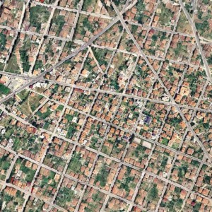
Cadastral Survey for the Creation of a National Cadastre in the Remaining Areas of the Thessaloniki Regional Unit

Cadastre & Land surveying

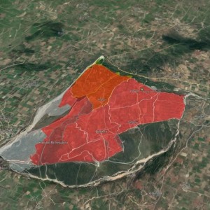
Consortis Implements a Vital Project for the Agricultural and Economic Development of Eastern Vistriza

Paliouri

Consortis’ Comprehensive Development Project at Xenia Paliouri

flyover

Flyover: Traffic Upgrade of Thessaloniki’s Inner Ring Road

Rethimno

Local Urban Plan of the Municipality of Rethymno

Cadastre & Land surveying

Scanning of Negative Aerial Photographs for the Archive of the Hellenic Cadastre

Cadastre & Land surveying

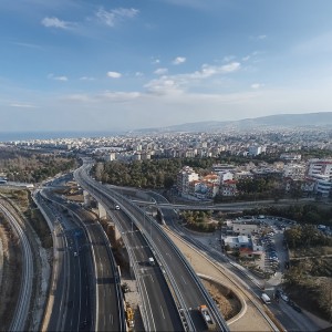
Survey and Architectural Documentation of the "Ktiriaches Ypodomes S.A." Building Complex in Agios Minas, Thessaloniki

Let’s discuss your project!

Main navigation

  • Home
  • About us
  • Services
  • Products
  • Projects
  • PASCO
  • Career
  • Insights & Articles
  • Contact

Secondary menu

  • Go to Consortis

Keep up to date with Consortis Geospatial

Subscribe here

Social

  • Facebook
  • Instagram
  • LinkedIn
  • YouTube

Quality & Information Security System

 Privacy Policy: Consortis Geospatial, Mobiroad, Landify, Maptheya, Evrymap | Cookies Policy | Terms of Use

Consortis Geospatial, All Rights Reserved © 2024

  • Phoenix Centre | 27 Georgikis Scholis Avenue 
    PO Box 4318 | 57001 Pylaia | Thessaloniki | Greece
    T: +30 2310 889 336, +30 2310 888 333
    E: geospatial@consortis.gr

  • Likavittou 5 | 10672 Kolonaki, Athens | Greece
    T: +30 210 3639799

G.E.MI.: 125458404000