LULC change analysis in support of the Greek national space project
The Greek national satellite space project: axis 3 land monitoring service aims to strengthen the country's capabilities in satellite technologies and applications while facilitating the exchange of satellite data. Its primary objective is to design, develop, launch, and pre-operate small satellites capable of hosting multipurpose payloads to address both national and European needs.
The initiative seeks to provide high-resolution imagery to various Greek civil, institutional, and governmental users, as well as potential European stakeholders within the frameworks of Copernicus and GEOSS (Global Earth Observation System of Systems).
Entirely funded by the European Union (EU) through the Recovery and Resilience Facility (RRF), the project supports critical applications, including Land Use/Land Cover Mapping, Deformation Monitoring, and Urban Analytics Services.
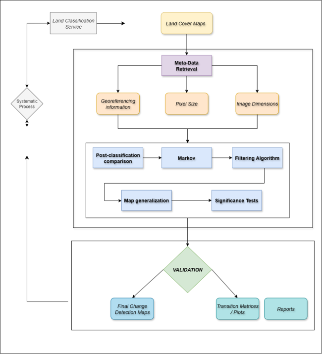
Consortis Geospatial has played a pivotal role in advancing geospatial technologies, particularly in change analysis. One of its key contributions is the development of a change analysis algorithm, designed to enhance the accuracy and efficiency of detecting and validating land surface transformations over time.
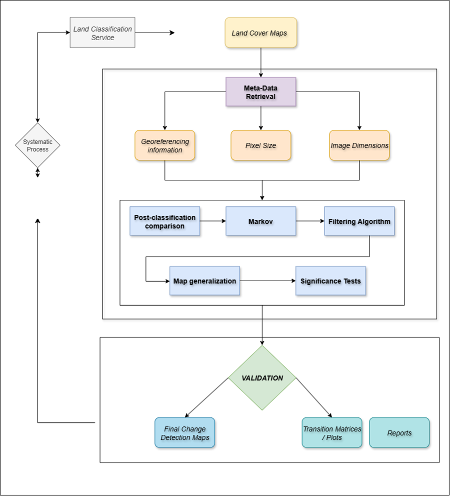
The main contribution of Consortis Geospatial was on land Cover Classification Change Detection for Environmental and Resource Management. In that respect, Consortis Geospatial led the:
✔ Development of high-accuracy land cover maps to support sustainable environmental monitoring and natural resource management.
✔ Monitoring land use and land cover (LULC) changes to ensure long-term environmental health and sustainability.
✔ Development of a dedicated, tailored, software for LULC change detection, precision assessment and validation with improved statistical metrics. Such change detection maps can contribute, to e.g., Agricultural Planning and Sustainable Land Use through:
✔ Enhancing agricultural planning by distinguishing between vegetation types, optimizing crop rotation, and improving soil management.
✔ Promoting precision agriculture through detailed classification and mapping of farmland. and to Disaster Risk Management and Early Warning Systems through:
✔ Utilizing land cover classification and feature extraction for early warning systems in detecting floods, wildfires, and other natural disasters.
✔ Providing real-time geospatial insights to mitigate disaster risks, protecting both lives and property.
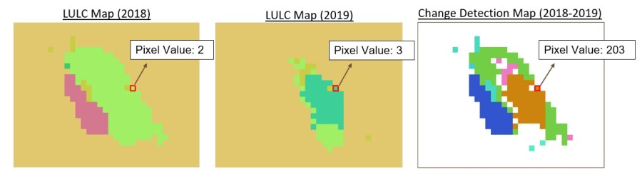
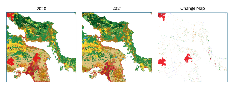
This advanced Land Cover change service by Consortis Geospatial will be a critical tool for policymakers, land managers, urban planners, and researchers, enhancing land management, disaster resilience, and environmental sustainability across Greece and beyond.
“The project is being carried out under an ESA Contract in the frame of the Greek National Satellite Space Project. The Project: Small-Satellites (Measure ID 16855) is implemented by the Hellenic Ministry of Digital Governance with the European Space Agency (ESA) Assistance in the Management and Implementation. The project is part of the National Recovery and Resilience Plan ‘Greece 2.0’, which is funded by the Recovery and Resilience Facility (RRF), core programme of the European Union-NextGenerationEU. Views expressed herein can in no way be taken to reflect the official opinion of the European Union/European Commission/European Space Agency/ Greek Ministry of Digital Governance.
Views and opinions expressed are those of the author(s) only and the European Union/European Commission/European Space Agency/ Greek Ministry of Digital Governance, cannot be held responsible for any use which may be made of the information contained therein.”