Public Real Estate Assets
Public Real Estate Assets
From fragmented records to integrated digital governance and sustainable asset utilization
━━━━━━━━━━━━━━━━━━━━━━━━━━━
Consortis Geospatial | Landify | 2026
Executive Summary
Real estate is a strategic asset not only for public administrations, but also for organizations and large companies managing significant property portfolios. These portfolios may include land, buildings, facilities, public-use or shared spaces, and properties subject to special regimes, each with distinct legal, technical, financial and operational characteristics. Their value extends well beyond market valuation and is closely linked to service delivery, operational continuity, social policy, spatial development, environmental protection and the energy transition.
Yet many public bodies, organizations and large companies still lack a single, up-to-date view of their property portfolios. Data is often dispersed across departments, software platforms, files and paper records, frequently with inconsistent or conflicting information. Fragmented data and responsibilities, the absence of standardized processes and limited specialist resources can lead to delays, weak oversight and missed opportunities for effective asset utilization.
This paper proposes a transition from basic inventorying to an integrated real estate lifecycle management model, built around a unified geospatial register. The register links the location and geometry of each property with its administrative, legal, technical, financial and operational record, while supporting user roles, access rights, digital workflows, alerts, change history, performance indicators and decision-support tools. Official cadastral and geospatial sources can strengthen this approach by providing authoritative reference data, without replacing the organization's operational system, which must also track use, maintenance, leases, concessions, pending issues, costs, revenues and utilization scenarios. International experience from the United Kingdom, Finland and the Netherlands shows that effective management of large real estate portfolios depends on strategic coordination, specialist organization, reliable data and continuous performance assessment.
1. Current conditions and systemic weaknesses
1.1 The fundamental question: "How many, which ones, and where?"
The first challenge is often the lack of a complete and reliable answer to three basic questions: how many properties does the organization own or manage, which properties are they, and where exactly are they located? An incomplete inventory does not necessarily mean that no data exists. More often, it means that multiple partial records exist in parallel, with varying levels of completeness, accuracy, terminology and reference dates.
Sources may include title deeds, formal decisions, cadastral information, accounting registers, survey plans, CAD files, Shapefiles and other geospatial data, paper files and records maintained individually by staff. Without a common identifier and a shared data structure, matching information across these sources becomes a manual process and often remains uncertain.
1.2 Fragmented information and responsibilities
Information about a property rarely sits within a single department. The technical team, for example, may know the property geometry and building condition, the finance team may manage leases and expenditure, and the legal team may track outstanding legal matters. Without a shared system and a clear update process, each department can end up maintaining its own version of the "truth".
The strategic management of large real estate portfolios is often constrained by unclear priorities, fragmented responsibilities across departments or organizational units, and insufficient coordination between them. This is not only an issue when dealing with major development opportunities. It reflects a broader governance and organizational challenge: without a shared view of the portfolio and effective coordination, decisions remain fragmented.
1.3 Inadequate data quality and currency
Even when a property has been recorded, critical information may still be missing, such as its exact area, current use, title of acquisition, planning status, technical condition, certificates, contracts, financial data or assigned asset manager. Information may also be outdated, lack a documented source or remain unverified.
Data quality is not a minor technical issue; it directly determines the quality of decisions. An incorrect boundary, an expired document that has not been recorded, or inaccurate land-use information can result in financial loss, legal exposure, project delays or difficulties in securing financing.
1.4 Limited staffing capacity
Many organizations do not have staff dedicated exclusively to real estate management. Knowledge is often concentrated among a small number of employees who also carry other responsibilities.
The answer is not simply to add more staff. What is needed is a combination of standardized processes, clearly defined roles, a digital audit trail and tools that reduce repetitive manual work. This allows the organization to operate through a structured management system rather than through personal files and individual experience.
2. From inventory to active management
2.1 Why a digital file is not enough
Moving a paper-based register into a spreadsheet or a basic database is a step forward, but it does not amount to integrated asset management. A static register mainly answers the question of what the organization owns or manages. An operational system must also show the current condition of each asset, who is responsible for it, what action is pending, which deadline applies, what it costs and which option creates the greatest value for the public body, organization or company. International practice increasingly treats large real estate portfolios as a distinct asset-management discipline rather than a simple record-keeping exercise.
3. Unified geospatial register and data management
3.1 The geospatial dimension
Real estate is inherently spatial. A property's location, boundaries and relationship to the road network, infrastructure, land uses, environmental constraints and neighboring properties directly affect how it can be managed and utilized. The map should therefore be more than a presentation layer; it should be a core working environment.
A web-based geographic information system (Web GIS) enables spatial search, visual comparison of datasets, identification of overlaps, support for field inspections and suitability analysis. At the same time, it allows non-specialist users to understand a property's location and context without having to work directly with specialist GIS or CAD files.
3.2 Common data model
The property register should be based on a common data model used across all relevant departments. The main categories of information include:
- name, category and responsible entity,
- geometry, area, address and administrative location,
- titles, method of acquisition, rights, encumbrances and legal matters,
- planning, forestry, archaeological and environmental status,
- actual use, users, concessions and leases,
- technical condition, permits, certificates, maintenance and technical works,
- energy performance, consumption, emissions and upgrade potential,
- financial data, revenues, expenditure, liabilities and value estimates,
- documents, photographs, drawings, inspections and change history,
- maturity indicators, risks, priorities and utilization scenarios.
3.3 Quality, provenance and reliability
Where appropriate, every significant data field should include its source, date of last update and level of reliability. Distinguishing between verified, provisional and unverified information is critical. This allows management to understand not only what information is recorded, but also how confidently it can be used.
Effective data governance requires designated owners for key information categories, validation rules, mandatory fields, geometry checks, duplicate-detection mechanisms and periodic verification procedures. Maintaining a complete change history makes it possible to identify who changed what, when the change was made and what evidence supported it.
4. Process digitalization and organizational model
4.1 From database to workflow
The system should support the actual administrative and operational processes involved in real estate management: registering a new property, verifying titles, updating use, managing leases or concessions, maintenance, certificate renewals, legal cases and the assessment of utilization proposals.
For each process, the triggering event, mandatory information, required documents, responsible person, review and approval levels, deadline and expected outcome should be clearly defined. The application should issue alerts for expirations and delays, maintain a full history and provide management with a clear overview of outstanding actions.
5. Technology architecture and interoperability
5.1 Core architectural principles
The technology solution should be open, scalable and interoperable, without dependence on proprietary data formats. A multi-layer architecture is recommended, combining a central relational and geospatial database, application services, a web-based management environment, Web GIS, document management, digital workflows, dashboards and data-exchange interfaces.
Directive 2007/2/EC (INSPIRE) and its technical implementation guidance emphasize the importance of common data models, metadata, network services and data-sharing rules so that spatial information from different sources can be combined and reused. Although a real estate register has a broader operational scope, these principles remain directly relevant to interoperability and the long-term sustainability of the solution.
5.2 Integrations
Integrations should be designed around clearly defined business needs and lawful access to data. The system may, for example, exchange information with:
- national cadastral systems and other authoritative spatial data sources,
- financial, accounting and fixed-asset systems,
- electronic document management and records systems,
- contract, lease and concession registers,
- planning, spatial, environmental and energy datasets,
- technical works, maintenance and facilities management systems,
- open-data and public-information platforms, where permitted.
5.3 Security, data protection and availability
The register will contain administrative and financial information of increased confidentiality and may also include personal data. Appropriate controls are therefore required, including role-based access, activity logging, encryption, backups, disaster-recovery planning, environment segregation and regular security reviews. Business continuity must also be ensured, as the system will support critical administrative and operational processes.
5.4 Landify: implementation of the proposed approach
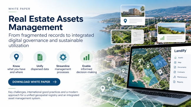
Landify is an integrated geospatial information system for real estate management. It translates the principles of a unified register and active asset management into a shared, web-based environment for multiple users and roles. More specifically, it provides the following capabilities:
Unified digital property file Brings together core, planning, technical, legal, ownership and financial information, together with documents and photographs. | Web GIS and search Displays and manages properties on the map and supports multiple search criteria and spatial identification. |
Processes and alerts Supports action tracking and automated notifications for lease expirations, certificates and other critical deadlines. | History and audit trail Maintains a complete field-level change history, strengthening accountability, traceability and data quality. |
Dashboards and reports Provides charts, statistics, indicators and automated portfolio reports. | Open architecture Supports integration with other applications and databases, scalability, user permissions and the use of open-source technologies. |
Landify's value extends beyond data visualization. It provides a shared workspace across departments, reduces dependence on personal files, applies validation rules and connects documentation with day-to-day monitoring. The data model and workflows can be adapted to the needs of each organization, allowing phased implementation without requiring a complete redesign of all processes from the outset.
6. International experience
International experience highlights a number of common principles for the effective management of large real estate portfolios across the public sector, organizations and large companies: central strategic coordination, specialist expertise, common data standards, continuous performance monitoring, and alignment of the portfolio with public-policy priorities or strategic business objectives.
In the United Kingdom, the Government Property Strategy 2022-2030 sets central priorities and standards for transforming the public estate, while the Government Property Agency manages a significant share of the government office portfolio and provides strategic property-management services.
In Finland, Senate Properties centrally manages the state's building portfolio, with an emphasis on lifecycle costs, maintenance and the disposal of assets that no longer serve public needs. In the Netherlands, Rijksvastgoedbedrijf brings together technical and management expertise for the buildings and land used by central government and the defence sector. The central lesson is the need to combine decentralized operational responsibility with common standards, shared data, clear performance indicators and an effective coordination mechanism.
Conclusions
Managing public real estate, as well as the property portfolios of organizations and large companies, is not a challenge that can be solved through a one-off inventory, a database or a standalone application. It is an ongoing management discipline in which legal documentation, geospatial information, technical condition, financial management, public or operational needs and strategic choices all converge.
Digital transformation, modern information infrastructures, the growing availability of geospatial and energy data, and increasing pressure for more efficient and sustainable management are creating a new operating environment for public bodies, organizations and large companies. The opportunity is not to build yet another isolated database, but to create an interoperable ecosystem that turns data into everyday administrative and operational capability.
The proposed model is based on a simple but demanding principle: for every property, the organization should know what it is, where it is located, its actual condition, who is responsible for it, what needs to happen next and what outcome is being pursued. When this information is unified, reliable and connected to operational processes, real estate ceases to be a passive or uncertain stock of assets and becomes an active instrument of public policy, organizational effectiveness and business strategy.
References and sources
[1] European Commission, Joint Research Centre. "Data Specifications Technical Guidelines - INSPIRE Knowledge Base". https://knowledge-base.inspire.ec.europa.eu/data-specifications-technical-guidelines_en
[2] UK Government Property Function (2022). Government Property Strategy 2022-2030. https://www.gov.uk/government/publications/government-property-strategy-2022-2030
[3] Government Property Agency. "About us". https://www.gov.uk/government/organisations/government-property-agency/about
[4] Senate Properties, Finland. "How we work". https://www.senaatti.fi/en/how-we-work/
[5] Government of the Netherlands. "Rijksvastgoedbedrijf (RVB)". https://www.rijksoverheid.nl/ministeries/ministerie-van-binnenlandse-zaken-en-koninkrijksrelaties/organisatie/organogram/rijksvastgoedbedrijf
Contact us for more information: