CONSORTIS GEOSPATIAL at the forefront of technological innovation!
From Geospatial Data to Real-World Decisions | Consortis Geospatial at INTERGEO 2026
How can geospatial technologies help us better understand our changing environment, anticipate natural hazards, and support critical decisions?
At INTERGEO 2026, Alexandros Ntoulas, Deputy Technical Director at Consortis Geospatial, joined INTERGEO TV to discuss the practical applications, opportunities, and challenges of geospatial technologies.
Drawing on projects and experience from Greece and the wider region, the conversation explores a range of topics:
- Preserving and unlocking historical geospatial information through the digitization of hundreds of thousands of aerial photographs for the Hellenic Cadastre.
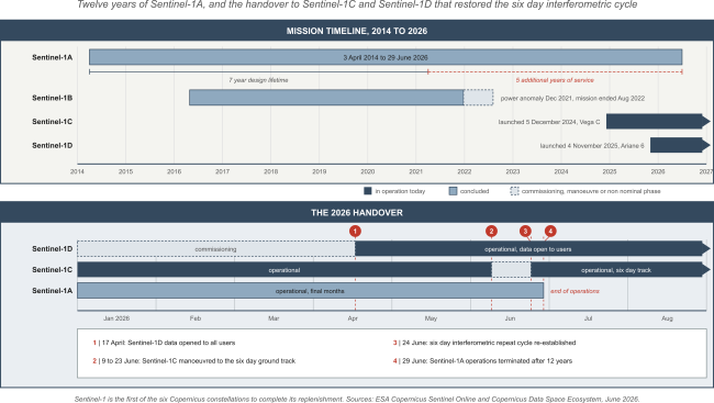
- Strengthening disaster preparedness through Earth Observation, radar interferometry, and Copernicus data for monitoring floods, wildfires, and earthquakes.
- Addressing cross-border challenges, particularly the exchange and integration of data for flood monitoring and risk management.
- Monitoring coastal erosion using satellite radar technologies and exploring their advantages over optical imagery.
- Making geospatial solutions more accessible and sustainable through open-source technologies, while addressing the challenges of data privacy in mobile mapping applications.
Beyond the technology itself, the discussion raises a fundamental question: How do we bridge the gap between geospatial information and the people who need it to make timely, informed decisions?
A question that captures the essence of this year's INTERGEO theme:
Real World. Real Data. Real Decisions.
Watch the full interview on INTERGEO TV:
https://www.youtube.com/watch?v=eQ7Ll0klz6Y