3D Visualization with LiDAR Technology
3D Visualization with LiDAR Technology
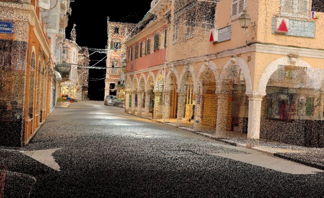
3D mapping and data collection through LiDAR revolutionize the creation of accurate and detailed models of natural and urban environments.
What we do
We have extensive experience in providing 3D point cloud services and collecting/processing LiDAR data. Using advanced LiDAR systems and scanning technologies, we deliver highly accurate 3D visualizations and models. Below are some indicative fields we have worked on:
Cartography: Creation of accurate digital maps, Digital Elevation Models (DEM), and Digital Surface Models (DSM)
Forestry: Mapping forest areas and creating forest registries
Construction and Mining: Producing digital terrain models for excavation and embankment volumes in road and railway projects
Coastal Zones: Rapid mapping of coastal zones and monitoring coastal erosion